
Alternative Navigation Sources
- Tizi

- Mar 31
- 5 min read
"I've intercepted the ILS glide slope" - Student flying in magenta needles
It’s pretty obvious that under IFR you must fly the appropriate navigation source for the type of route or approach you are executing. For example, if you shoot an ILS approach, you will fly raw ground based data (the famous “green needles” for Garmin), sourcing VOR/LOC (i.e., VLOC) and not GPS.

Garmin’s color coding for navigation sources has become part of the industry’s standard. Garmin displays CDI needles in magenta when they are using GPS data. If you are sourcing VLOC (VOR Localizer), then the CDI needles will be shown in green.
Back in the day (when the trains were on time and Queen was rocking the world [if you don’t know Queen, revisit your musical knowledge]), you executed your entire flight in a single navigation source. The infrastructure was a lot simpler back then, and pilots had less options when it came to navigation sources. With the advent of GPS (and RNAV actually), this conversation became a little more complicated.
What happened is that the FAA determined that pilots have more than one navigaiton source available to them to fly certain routes. For example, if I fly a Victor Airway (composed of VOR-based guidance), why can't I fly it using GPS instead? I mean, a line is a line, so how I fly it should be relatively irrelevant. To acknowledge this reality, the FAA wrote an Advisory Circular, AC 90-108, which will soon be replaced by AC 90-119. Those documents, coupled with AIM 1-2-3 provide clear guidance on how you can use "alternate means of navigation" for certain routes and approaches.
Here is a breakdown of general situations, as they apply to today’s infrastructure and regulatory environment:
Path | Notes | Graphic | Approved Navigation Source | Garmin Needle Colors |
Victor Airways | Originally designed for VOR navigation, but can be flown with GPS. |  | VLOC or GPS | Green or Magenta |
Jet Airways | Originally designed for VOR navigation, but can be flown with GPS. |  | VLOC or GPS | Green or Magenta |
Tango Airways | Designed for GPS, can only be flown with GPS. |  | GPS | Magenta |
Quebec Airways | Designed for GPS, can only be flown with GPS. |  | GPS | Magenta |
RNAV (GPS) Approaches | Designed for GPS, can only be flown with GPS. |  | GPS (RNAV) | Magenta |
VOR Approaches | Designed for VOR, but can also be flown with GPS, as long as you track the VOR somehow (bearing points, backup CDI, etc.). Read below for further details on this topic... | 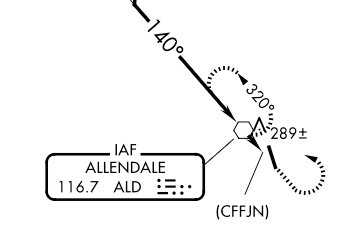 | VLOC or GPS backed up with VLOC | Green or Magenta backed with Green |
LOC / ILS Approaches | Designed for localizer and glide slopes. Cannot be flown with GPS. |  | VLOC | Green |
Switching Sources on Approach
There are many cases where we switch navigation source, like on an ILS/LOC or VOR approach. We therefore need to also talk about switching navigation sources and understand what the regulations tell us.
For example, what if you arrive at the IAF of an ILS approach using GPS? When are you required to switch from magenta needles to green needles (GPS to VLOC)? Well, the regulations are again provided in AC 90-108 (which will soon be replaced by AC 90-119 in draft), and in AIM 1-2-3.
Brace yourself. There is some legalism...
Someone reading the Advisory Circular and the AIM would conclude the following. One must
Fly in VLOC the entire LOC/ILS approach.
Fly in VLOC the final approach segment of a VOR approach. The previous approach segments could be flown under GPS.
Rule (1) is correct, but rule (2) requires clarification. I'm not trying to confuse you, but if you google this stuff, you will find a lot of superficial interpretations of the FARs and might lead you to the wrong confusion. So if you read the above statements somewhere online, please know that there is more!
AC 90-108 paragraph 8(b) says the following:
"8. USES OF SUITABLE RNAV SYSTEMS NOT ALLOWED BY THIS AC. An otherwise suitable RNAV system cannot be used for the following:
b. Substitution on a Final Approach Segment. Substitution for the NAVAID (for
example, a VOR or NDB) providing lateral guidance for the final approach segment."
You would imagine that you cannot substitute the VOR with GPS on the final approach segment of a VOR approach. Legally, yes, but practically, not...
There is some legalism that needs to be addressed, primarily "substitution" vs. "alternate means of navigation". AIM 1-2-3 covers this. In essence:
Alternate Means of Navigation implies you choose to use another type of navigation source out for whatever reason. Say you fly a Victor Airway using GPS. That's fine.
Substitution implies that you are replacing the navigation source. So imagine you fly that Victor airway using GPS when the VORs are offline. That's a slightly different scenario...
AIM 1-2-3 paragraph 8(b) above indicates that you cannot substitute. So you can't fly a VOR's final approach segment by just using GPS. However, if you keep reading the AIM (which you love doing so much...), you will also read the following statement:
"5. Use of a suitable RNAV system as a means to navigate on the final approach segment of an instrument approach procedure based on a VOR, TACAN or NDB signal, is allowable. The underlying NAVAID must be operational and the NAVAID monitored for final segment course alignment."
That statement indicates that you can use the RNAV system as an alternative means of navigation (i.e., the VOR must be online) and that you must monitor that VOR for course alignment.
Therefore,
you can fly an entire VOR approach using GPS, as long as you monitor the VOR somehow. I would tune a backup CDI or engage a VLOC-based bearing pointer!
For the question on when should one switch from GPS to VLOC on a LOC/ILS, the answer is "as soon as you're on the localizer". AC 90-108 specifically states the following:
"Lateral navigation on LOC-based courses (including LOC Back-course guidance) without reference to raw LOC data."
Some would argue that this applies for the inbound course only. That is, not if you're flying backwards on the localizer, like for a procedure turn. I will not provide legal interpretation on this, however I will provide the following advice:
Turn on VLOC as soon as possible to verify the VLOC signal is appropriate and functional.
For example, look at the KSAV ILS 10 approach:

Lets' say you proceed direct TILEE from the southeast (bottom right) for a procedure turn. I would stay on GPS until I am completing the procedure turn, so that when I'm intercepting I switch to VLOC and track the localizer inbound. I also prefer to stay in GPS as I begin the procedure turn in case I'm told to hold at TILEE for whatever reason. GPS holding is a lot easier than VLOC-based holds!


Comments